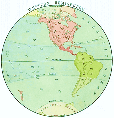
Look at the picture, and you will see land all along the right-hand side, stretching from the upper part of the picture almost to the lower, or from the North to the South. That land is America. At the middle, or Center, the land is very narrow, and because it is a narrow neck of land it is called an Isthmus. The land from this isthmus toward the north is the continent of North America, and that from the isthmus toward the south is the continent of South America. North America and South America are joined to each other by the Isthmus of Darien or Panama.
Point to North America and to South America.
Imagine a cruise ship sailing on the Atlantic Ocean. What is pictured is but a small part of the Atlantic. From what land do you imagine your steamship is sailing? To what land is it sailing? Is it sailing north, or south?
The continents which you cannot see on this picture are Asia, Europe, and Africa. North America, South America, Europe, Asia, and Africa are Grand Divisions of the land on the Earth, also called continents.
Notebook Work: Color and label the continents on the map of the Earth.
 First Lessons in World Geography
World Geography
First Lessons in World Geography
World Geography


 About
About Curriculum
 Navigation